There are several GPS systems around the world. GLONASS, alongside GPS, Galileo, Beidou and others are working towards the goal of providing the most accurate data for its users. Each navigation system has its differences and main area it focuses on the most.
GLONASS is a Russian satellite-based navigation system that works as an alternative to GPS. GLONASS and GPS can together provide 20% increase in providing satellites than devices that rely on GPS alone.
What is GLONASS?
Global Navigation Satellite System (GLONASS) is a satellite navigation system developed and operated by Russia that consists of 24 satellites. GLONASS is typically used by many satellite navigation manufacturers as it provides them with more satellites available and therefore, positions are more accurate and can be fixed quickly.
Russians started developing the system in 1976 and launched the first GLONASS satellite in 1982. The constellation itself became fully operational in 1995.
There are five versions of GLONASS:
-
GLONASS: Launched in 1982 for the military and official organizations, intended for weather, positioning, timing and velocity measurements.
-
GLONASS-M: Launched in 2003 for adding second civil code.
-
GLONASS-K: Launched in 2011 for adding third civil frequency.
-
GLONASS-K2: Was supposed be launched at the end of 2021, but got postponed to 2022.
-
GLONASS-KM: Will be launched by 2025-2030 and is currently in the research phase.

How Does it Work?
The GLONASS constellation provides good visibility to number of satellites, depending on your specific location. Four satellites are the minimum, which allows GLONASS receiver to compute its position in three dimensions, similarly to the GPS system.
The GLONASS space segment consists of 24 satellites, in three orbital planes and eight satellites per plane. The constellation geometry repeats once every eight days. The GLONASS satellite signal identifies the satellite and includes:
-
Positioning, velocity, and acceleration information.
-
Satellite health information.
-
Offset of GLONASS time from UTC.
-
Almanac of all other satellites.
Orbit Radius: 19,140 km.
Orbital Inclination: 64.8 degrees.
Orbital Planes: 3.
Improve Vehicle Tracking with Real-Time Data
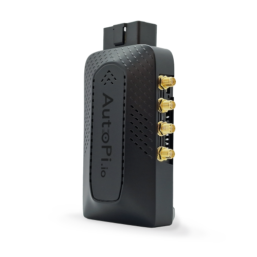
GLONASS gives you accurate location data, but combining it with real-time vehicle information takes things to the next level. The AutoPi CAN FD Pro connects to your vehicle’s systems and gathers key data, like speed, fuel usage, and engine health.
By linking AutoPi CAN FD Pro with your GPS or GLONASS system, you get more than just location data — you gain a full view of your vehicle’s condition. This makes it easier to track performance, plan maintenance, and improve efficiency.
Whether you’re managing a few vehicles or a large fleet, AutoPi CAN FD Pro helps you make better decisions with accurate, real-time data, improving everything from fuel efficiency to maintenance schedules.

GLONASS Control Segment
The GLONASS control segment consists of network of command tracking stations across Russia and the control system center. The control segment monitors the health of the satellites, determines the ephemeris corrections and satellite clock offsets, respecting the GLONASS time and UTC.
“The Earth was absolutely round… I never knew that the word ‘round’ meant until I saw Earth from space.”
- Alexei Leonov, Soviet Astronaut on his historic spacewalk in 1985.

GLONASS vs Galileo
GLONASS is usually more accurate in mountainous areas, while Galileo is more accurate in urban areas. Galileo should be slightly more accurate than GLONASS, depending on its surroundings. GLONNAS is Russian satellite navigation system and Galileo is European.
GLONASS vs GPS
GPS should be generally more accurate than GLONASS (3.5-7.8m compared to 5-10m), which lowers the number of errors. The positioning of GLONASS satellites is different, that’s why it works better at high latitudes.
The Global Navigation Satellite System is a crucial pillar of many businesses, and they rely on its accurate data information, mostly vehicle data. Working with IoT and AI within automotive industry, you are most likely hearing a lot about GPS.
In order to monitor your fleets or fixed assets, your solution highly depends on accurate GPS data, same as in Telematics. Let’s take a look at two use cases: Keyless Entry and Fleet Management. Both solutions are highly depended on the accuracy and speed of the satellite navigation system.
There are plenty of different use cases where the GLONASS or GPS in general is being used daily and becomes a critical aspect of the operations.
| GLONASS | GPS |
|---|---|
|
Introduction: Globalnaya Navigazionnaya Sputnikovaya Sistema or GLONASS is Russia's global navigation satellite system. Operational since 1993, it provides real-time positioning and velocity data. |
Introduction: Global Positioning System or GPS is a US-owned utility providing users around the world with positioning, navigation, and timing (PNT) services. Operational since 1978. |
|
Satellites: GLONASS operates with around 24 satellites orbiting the earth, ensuring global coverage. |
Satellites: GPS operates with around 31 satellites in orbit around the earth, also ensuring global coverage. |
|
Frequency: GLONASS uses two frequencies for civilian use, which can help reduce the impact of signal interference. |
Frequency: GPS initially used one frequency for civilians, but modern GPS receivers use multiple frequencies to improve accuracy. |
|
Accuracy: GLONASS provides an accuracy of 5-10 meters for civilian use. |
Accuracy: GPS provides an accuracy of around 3.5-7.8 meters for civilian use. |
|
Signal Availability: GLONASS signal availability is generally strong in northern latitudes, including Russia and North Pole regions. |
Signal Availability: GPS offers consistent signal availability globally. |
In conclusion, both GLONASS and GPS have their strengths, providing global navigation and timing services. The choice between the two may depend on your specific needs and location.
Let us know if you found the information you were looking for and do not hesitate to reach out to
us.


